SOIL EROSION IN PAKISTAN
Soil erosion is of two types; it may be geological and accelerated. In geological erosion, the soil losses are equal to the amount of soil formation; the soil productivity is adversely affected. While in accelerated erosion, the rate of soil loss is greater than the rate of soil formation.
مٹی کا کٹاؤ دو طرح کا ہوتا ہے۔ یہ ارضیاتی اور تیز ہو سکتا ہے۔ ارضیاتی کٹاؤ میں، مٹی کے نقصانات مٹی کی تشکیل کی مقدار کے برابر ہوتے ہیں۔ مٹی کی پیداواری صلاحیت بری طرح متاثر ہوتی ہے۔ تیز کٹاؤ میں، مٹی کے نقصان کی شرح مٹی کی تشکیل کی شرح سے زیادہ ہے۔
Extent of Erosion in Pakistan
In Pakistan, the total land area is 79.61 million hectares; 20.61 million hectares are under cultivation; 3.16 million hectares are under forest cover; and 11.10 are not available for cultivation practices. According to an estimate, 76% of the area is affected due to erosion, out of which 36% by flood and 40% by wind erosion. Dry and sandy regions are mostly affected by wind erosion areas balochistan Balochistan, CholisanBalochistan, Cholisan, and thal in punjab and thar in sindh, due to high temperature dust storms and sand dunes, dam the soil and choke the waterways. Annually, 14000 hectares of land go out of cultivation in Pakistan. Water erosion is more prevalent in northern hilly areas, the Pothwar plateau, and the flanks of Punjab near the foothills of the Himalayas. The rainfall in these areas are 250-1000 mm per annum, and they have uneven topography. About 50% of rainwater is lost as runoff. If half of this water is stored, it would be equal to 6 million acre feet of water which is equal to two-third of the usable capacity of Terbela dam enough to irrigate 4 million acre of land.
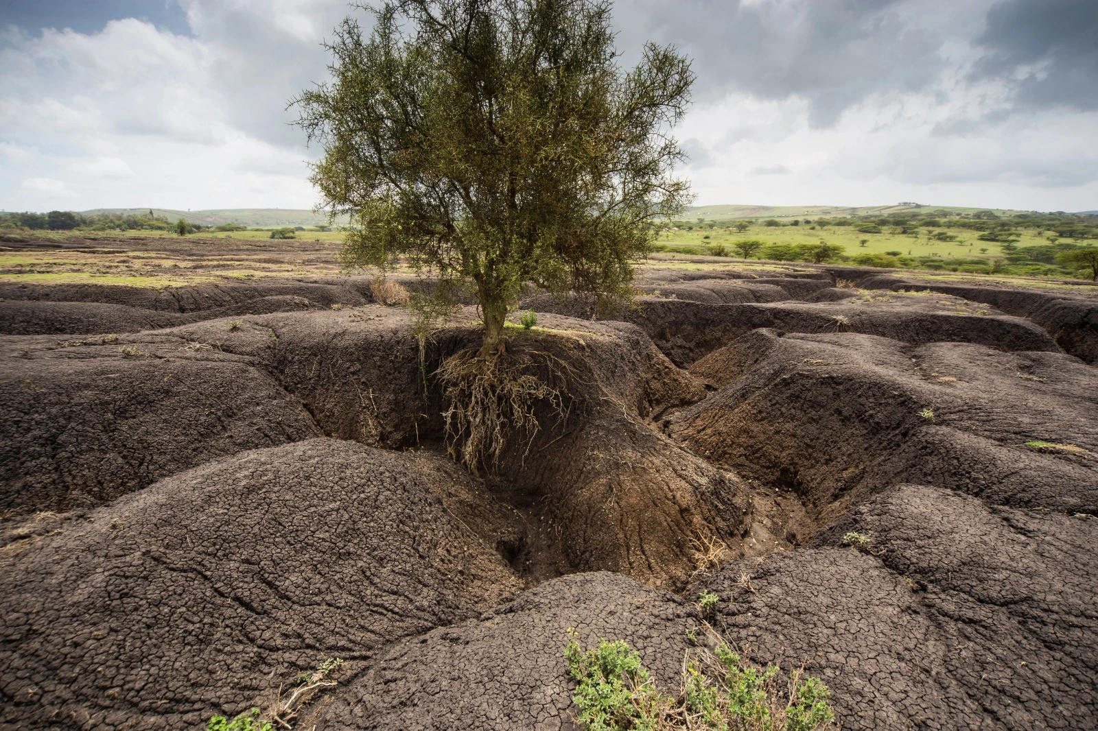
پاکستان میں کل رقبہ 79.61 ملین ہیکٹر ہے۔ 20.61 ملین ہیکٹر زیر کاشت ہے۔ 3.16 ملین ہیکٹر جنگلات کے نیچے ہے۔ اور 11.10 کاشت کے طریقوں کے لیے دستیاب نہیں ہیں۔ ایک اندازے کے مطابق 76% علاقہ کٹاؤ کی وجہ سے متاثر ہوا ہے جس میں سے 36% سیلاب سے اور 40% ہوا کے کٹاؤ سے۔ خشک اور ریتلی علاقے زیادہ تر ہوا کے کٹاؤ کے علاقوں سے متاثر ہوتے ہیں بلوچستان بلوچستان، چولیسان بلوچستان، چولیسان، اور پنجاب میں تھل اور سندھ میں تھر، زیادہ درجہ حرارت کے گردو غبار کے طوفانوں اور ریت کے ٹیلوں کی وجہ سے مٹی کو بند اور آبی گزرگاہوں کو دبانا پڑتا ہے۔ پاکستان میں سالانہ 14000 ہیکٹر رقبہ کاشت سے باہر ہو جاتا ہے۔ پانی کا کٹاؤ شمالی پہاڑی علاقوں، پوٹھوار سطح مرتفع اور ہمالیہ کے دامن کے قریب پنجاب کے اطراف میں زیادہ پایا جاتا ہے۔ ان علاقوں میں بارش 250-1000 ملی میٹر سالانہ ہوتی ہے، اور ان کی ٹپوگرافی ناہموار ہوتی ہے۔ تقریباً 50% بارش کا پانی بہنے کے طور پر ضائع ہو جاتا ہے۔ اگر اس پانی کا نصف ذخیرہ کیا جائے تو یہ 6 ملین ایکڑ فٹ پانی کے برابر ہوگا جو تربیلا ڈیم کی قابل استعمال صلاحیت کے دو تہائی کے برابر ہے جو 4 ملین ایکڑ اراضی کو سیراب کرنے کے لیے کافی ہے۔
Mechanics of water erosion in soil
when rain water touches the ground it breaks the soil clods into pieces these small particles supended on the soil surface and form a muddy suspension , some of this suspension percolates down the soil while some results in runoff ,when water p[ercolates into the soil the particles enter the soil pores and block them in this way they ceases the soil pores and water stops to percolate down the soil; hence, there will be more runoff.
جب بارش کا پانی زمین کو چھوتا ہے تو یہ مٹی کے لوتھڑے کو ٹکڑے ٹکڑے کر دیتا ہے یہ چھوٹے ذرات مٹی کی سطح پر لٹکتے ہیں اور ایک کیچڑ والا سسپنشن بناتے ہیں، اس سسپنشن میں سے کچھ مٹی کے نیچے ٹکراتے ہیں جبکہ کچھ کا نتیجہ بہہ جاتا ہے، جب پانی مٹی میں داخل ہوتا ہے تو یہ ذرات مٹی کے سوراخوں میں داخل ہو جاتے ہیں اور اس طرح ان کو روکتے ہیں تاکہ وہ گرنا بند ہو جائیں اور پانی بند ہو جائے۔ لہذا، وہاں زیادہ رن آف ہو جائے گا.
Forms of water erosion
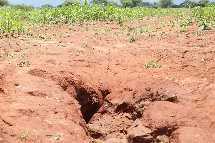
There are four types of water erosion 1-splash erosion 2) sheet erosion 3) rill erosion and 4- gully erosion.
In these kinds first splash or raindrop erosion is occur raindrop strikes the land surafce breaks the clods and aggregate with the greta force , smaller particles splash in the air and the soil layer become puddled and compacted. While in case of sheet erosion uniform sheet of thin layer of fertile soil is loss, a productive layer los due to erosion it may be goes to remove 15 cm, layer of soil in some areas.Rill erosion is the formation of small rivulets on the surface its the transitional phase between sheet and gully erosion, they can be manged smoothig the soil. In case of guly erosion , small channels are formed which may take a shape of large gullies which remove lot of soil and they cause damage in highland areas, Shrubby plants should be grown in such areas and it is very difficult to manage gullies because it removes almost more soil and causes greater damage then any other kind of water erosion, gullies remain active until they are stabilized by vegetations, hard and compact soil subjected to sheet erosion while lose, open and well drained soil subject to gully erosion.They mostly developed in western pothwar plateau.
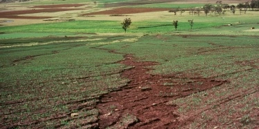
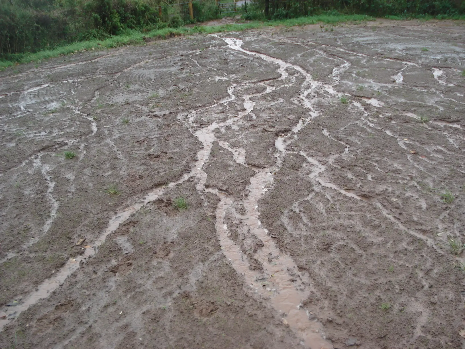
پانی کے کٹاؤ کی چار قسمیں ہیں 1-سپلیش ایروشن 2) شیٹ کا کٹاؤ 3) ریل کا کٹاؤ اور 4- گلی کا کٹاؤ۔ ان قسموں میں پہلا چھڑکاو یا بارش کے قطرے کا کٹاؤ ہوتا ہے بارش کے قطرے سے زمینی سطح پر ٹوٹ پھوٹ ہوتی ہے اور گریٹا فورس کے ساتھ جمع ہو جاتی ہے اور اس طرح چھوٹی چھوٹی تہہ بن جاتی ہے اور ہوا کی تہہ بن جاتی ہے۔ کمپیکٹڈ جب کہ شیٹ کے کٹاؤ کی صورت میں زرخیز مٹی کی پتلی پرت کی یکساں شیٹ کا نقصان ہوتا ہے، کٹاؤ کی وجہ سے پیداواری پرت 15 سینٹی میٹر، کچھ علاقوں میں مٹی کی تہہ کو ہٹانے کے لیے جاتی ہے۔ گلیوں کے کٹاؤ کی صورت میں، چھوٹے نالے بنتے ہیں جو بڑی گلیوں کی شکل اختیار کر لیتے ہیں جو بہت ساری مٹی کو ہٹاتے ہیں اور وہ اونچے علاقوں میں نقصان پہنچاتے ہیں، ایسے علاقوں میں جھاڑی والے پودے اگانے چاہئیں اور گلیوں کا انتظام کرنا بہت مشکل ہے کیونکہ یہ تقریباً زیادہ مٹی کو ہٹاتا ہے اور زیادہ نقصان پہنچاتا ہے، پھر کسی بھی قسم کے پانی کے کٹاؤ، گلیاں اس وقت تک متحرک رہتی ہیں جب تک کہ وہ مضبوط نہ ہو جائیں اور وہ مضبوطی سے کام نہ کریں۔ چادر کے کٹاؤ کو کھونے کے دوران، کھلی اور اچھی طرح سے نکاسی والی مٹی گلیوں کے کٹاؤ کے تابع ہے۔ وہ زیادہ تر مغربی پوٹھوار سطح مرتفع میں تیار ہوئے۔
Soil Conservation Practices
- Rainfall
it has direct impact on erosion, the greater the rainfall the greater will be the erosion, heavy downpours over a short period of time result i greater soil loss than low intensity rain at the same topographic conditions. Intensity of rainfall matters most i this case. But in Paksitan there is general deficiency of rainfall in upper sindh its 125 mm annyally while in sub-mountaneous northern areas it is 900 mm. In Balouchistan it is 200mm while in desert kharan it is 50 mm.In areas like swat abbotabad murree kahuta it is 1000 mm. Himalayas 150 mm and 250-750mm in western plateau while in the desert areas it is less than 125mm like Dera Ghazi Khan.
اس کا براہ راست اثر کٹاؤ پر پڑتا ہے، جتنی زیادہ بارش ہوگی اتنا ہی زیادہ کٹاؤ ہوگا، قلیل مدت میں شدید بارش کا نتیجہ اسی ٹپوگرافک حالات میں کم شدت والی بارش سے زیادہ مٹی کا نقصان ہوتا ہے۔ بارش کی شدت اس معاملے میں سب سے زیادہ اہمیت رکھتی ہے۔ لیکن پاکستان میں بالائی سندھ میں بارش کی عمومی کمی ہے اس کی سالانہ 125 ملی میٹر جبکہ زیریں پہاڑی شمالی علاقوں میں یہ 900 ملی میٹر ہے۔ بلوچستان میں یہ 200 ملی میٹر ہے جبکہ صحرائی خاران میں یہ 50 ملی میٹر ہے۔ سوات ایبٹ آباد مری کہوٹہ جیسے علاقوں میں یہ 1000 ملی میٹر ہے۔ ہمالیہ 150 ملی میٹر اور مغربی سطح مرتفع میں 250-750 ملی میٹر جبکہ صحرائی علاقوں میں یہ ڈیرہ غازی خان کی طرح 125 ملی میٹر سے کم ہے۔
- Slope length and Steepness
Longer the slope more will be runoff and erosion, it is expressed in degree and percentage. Both the length and steepness of the slope affect the magnitude and extent of erosion. Water moves slowly over a gentle slope, and its speed increases with an increase in steepness.
- Vegetation also plays a very important role in soil erosion reduction. Erosion decrease when plant cover increases upto 30%.
- there are many variables of soil erosion that can be used to check the soil loss due to water erosion they are collectively called as universal soil loss equation discovered by weschmeirier and smith 1965-1980 .
- A= R K L S C P
ڈھلوان زیادہ لمبا بہہ اور کٹاؤ ہوگا، اس کا اظہار ڈگری اور فیصد میں ہوتا ہے۔ ڈھلوان کی لمبائی اور کھڑی پن دونوں ہی کٹاؤ کی شدت اور حد کو متاثر کرتی ہیں۔ پانی ایک ہلکی ڈھلوان پر دھیرے دھیرے آگے بڑھتا ہے، اور اس کی رفتار کھڑی پن میں اضافے کے ساتھ بڑھ جاتی ہے زمینی کٹاؤ کو کم کرنے میں پودوں کا بھی بہت اہم کردار ہے۔ کٹاؤ کم ہوتا ہے جب پودے کا احاطہ 30% تک جاتا ہے۔مٹی کے کٹاؤ کے بہت سے متغیرات ہیں جو پانی کے کٹاؤ کی وجہ سے مٹی کے نقصان کو جانچنے کے لیے استعمال کیے جاسکتے ہیں جنہیں اجتماعی طور پر مٹی کے نقصان کی عالمگیر مساوات کہا جاتا ہے جسے ویسمیریئر اور اسمتھ نے 1965-1980 میں دریافت کیا تھا۔
A = soil loss in metric tonnes per hectare_(tha¯¹).,R = rainfall and runoff factor - rainfall erosivity (j ha¯¹), K = soil erodability factor-soil loss per rainfall erosivity unit from a unit plot (a bare, fallow, 9 percent slope of 22.6 m length), ex-pressed in metric tonnes per joule (t j¯¹).LS = slope length and steepness factor (compared to reference values of 22.6 m length and 9 percent slope), dimensionless ,= crop management factor - a ratio which compares soil loss from an , experimental field with that from a field with standard treatment, dimensionless. P = conservation practice factor - a ratio which compares soil loss with that from a field with no conservation practices, dimensionless.The permissible limit of soil loss is stipulated as 12.5 if the value exceeds then adjustments made in LS C and P.
A = مٹی کا نقصان میٹرک ٹن فی ہیکٹر میں_(tha¯¹)۔،R = بارش اور بہاؤ کا عنصر - بارش کی خرابی (j ha¯¹)، K = مٹی کی خرابی کا عنصر - ایک یونٹ پلاٹ سے مٹی کا نقصان فی بارش کی مٹی کا نقصان j¯¹) LS = ڈھلوان کی لمبائی اور ڈھلوان کا عنصر (22.6 میٹر لمبائی اور 9 فیصد ڈھلوان کی حوالہ جاتی قدروں کے مقابلے)، جہت کے بغیر = فصل کے انتظام کا عنصر - ایک تناسب جو کسی، تجرباتی فیلڈ سے مٹی کے نقصان کا موازنہ معیاری علاج کے ساتھ کھیت سے کرتا ہے، جہت کے بغیر۔ P = کنزرویشن پریکٹس فیکٹر - ایک تناسب جو کسی ایسے کھیت سے مٹی کے نقصان کا موازنہ کرتا ہے جس میں کوئی تحفظ نہیں ہے، بغیر جہت کے۔ مٹی کے نقصان کی قابل اجازت حد 12.5 مقرر کی گئی ہے اگر قدر سے زیادہ ہو تو LS C اور P میں ایڈجسٹمنٹ کی جاتی ہے۔